Sunday, 3 January 2010

Krakow, Riga, Warsaw, Svidnik and Dubrovnik

The Oracle Univesity organized a two day seminar in Riga, Latvija at the end of August 2009. This was a nice opportunity to make a stop in Krakow in Poland. As we had quite short vacations in July we used also this opportunity to spent additional five days on Island of Mljet near Dubrovnik in Croatia.

Interactive GPS track - click here to enlarge the map


The plan was to make a refueling stop in Vyškov near Brno in Czech Republic and then proceed to Krakow. Later on I found that on Pobiednik Wielki airfield there is a gas station just outside the airfield fence only about 30 meters away from the main apron.
The planned and actually flown route was:
LJDI - TREBNJE (VFR reporting point) - RADLY - STO - MIKOV - LKVY

We started on August 24th in the morning and the flight to Vyškov was a routine VFR flight in excellent weather conditions. I have visited Vyškov already once this year when we were flying back from Finland. I phoned them a day before and and we were immediately warmly welcomed for refueling.

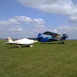
The next leg was from Vyškov (LKVY) to Pobiednik Wielki (EPKP) near Krakow in Poland. The planned and actually flown route was:
LKVY - HLV - TUSIN - SKAVI - EPKP.

The weather was still excellent but we got broken clouds near Krakow so we had to postpone the descend a little bit in order to find a suitable hole in the clouds.

After securing the aircraft at EPKP we called taxi and drove to the center of Krakow where we had a reservation in a just refurbished hotel which was re-opened just two days before.
After a quick lunch with original Polish dishes we headed to the main square in Krakow and had short sightseeing of surrounding churches. Next morning we took a guided 4 hours visit of Krakow castle and Krakow Ghetto.

Photo album of visiting Krakow City


In the afternoon we took taxi to Pobiednik Wielki and headed towards Adaži near Riga in Latvia.
The planned route was: EPKP - JED - LIN - SIE - BOKSU - GUNTA - VISTA - EVAD.
I checked the Polish Airspace Use Plan (AUP) for the current day before filing the flight plan by phone. The weather was excellent all way to the north and we landed at Adaži (EVAD) short before the sunset. EVAD is a former agriculture airfield now privately owned and mostly used for training for ULA and GA airplanes. It is located about 40 minutes drive north east of Riga. They provided me MOGAS which they buy at the nearby gas station.

Riga is for sue one of the most beautiful towns we ever visited and we enjoyed our stay there really very much.

Visiting Riga Town


On Friday, August 28th in the afternoon, immediately after I have finished my class, we took a taxi back to Adaži and headed to Warsaw - Babice (EPBC) where I planned a night landing. The planned route was:
EVAD - VISTA - GUNTA - BOKSU - SUW - ULPAR - JULLIET (VFR point for Babice) - LIMA (VFR point for Babice) - EPBC.
As I was never before at Babice it was a little bit of challenge to make first landing there at night. Babice is located in the middle of Warsaw city and it was hard to spot the airfield as we were vlying very low due to the airspace above us.
Next morning we planned to continue our trip to Svidnik in Slovak Republic. The Babice airfield opens at 6:00 AM local time and we came there at about that time. Shortly after arrival we were already airborn and were heading towards LZSK.
The planned route was:
EPBC - WAR - BRAVO - ALPHA - TANGO - ARDAG - PODAN - LZSK.

A cold front was coming from the west and we had to be on time in Svidnik for refueling and continuation to Dubrovnik in order to escape before the bad weather.
On Saturday, August 29th they had annual gathering at Svidnik(LZSK) airfield and it was quite a lot of people already there. It was nice to meet Tomáš and Emil Sluk again. This time we also met Koka, a good friend of late Robert Tupta, for the first time and we became good friends. After refueling and a short chat with these nice people we had to leave. Again this time we really enjoyed a short stay at Svidnik.

See photo album of visiting Svidnik


The cold front was rapidly traveling to the east and therefore headed to Košice (LZKZ) where we landed just to exit the Schengen area. The route was LZSK - RUSKOV (VFR entyr pint to Košice CTR)- LZKZ. The border control was very efficient and they came to the GA office to check our documents, so we could continue our journey to Dubrovnik (LDDU) pretty soon. The route was:
LZKZ - KEKED - SAG - BAREB - SIVLA - KEB - MADOS - LDDU.

While we were flying across Hungary we could see the on our right side the cold front. As we were on time we actually had no problems with the weather and were flying in clear sky. After entering Bosnia and Herzegovina at SIVLA point we found some tower cumulus buildups so we climbed to FL120 and remained at this level almost all the way across Bosnia and Herzegovina. We crossed the Croatian border at FL100 at MADOS point which is almost at the Dubrovnik airport. Although VFR we were vectored for ILS approach for RWY 12 which of course I have accepted with great pleasure.

We stayed for few days at Restaurant Ogigija and enjoyed their hospitality again.

Tuesday, 29 December 2009

Birthday Trip To Split (LDSP)


On December 28th 2009 I was celebrating my 55th birthday and for this occasion I invited my wife Lili for a one day trip to Split in Croatia where I have never been before.
As Croatia is not part of Schengen area we had to fly first to Portorož (LJPZ) to exit Schengen area and then to Split airport (LDSP) - Kaštela, located about 35 minutes drive away from Split town. The airport is located in a wonderful surrounding. I used this opportunity to do some training and I asked for a simulated ILS approach to RWY 05 which was immediately approved. The planned route from Portorož to Split was: LJPZ - PS1 - CRE - LOS- SAL - DVN - LDSP. Unfortunately I had to divert due to parachute activity over Lošinj airport (LDLO) and the actually flown route was over Zadar airport (LDZD) direct to DVN NDB which is entry point (final approach fix - FAF) for ILS approach. The weather was excellent although there were some cloudy areas in Kvarner golf with base at 3000 feet. So I asked for 5500 feet which was our cruising altitude all the way to DVN where I had to descend to 2800 feet in order to be at the right altitude for simulated ILS approach.

After landing we had refueled with AVGAS 100L. As usually the price of gasoline was low - 1,20 EUR per liter. Although I'm using MOGAS most of the time I have to purchase some AVGAS from time to time according to the instructions in STC for mogas. The landing fee was 26 EUR.

We took a regular local bus from airport to Split town and we enjoyed very much the scenery with many lemon, orange and mandarin trees full of mature fruits.
In Split we passed the old historical part of the town and had some coffee and cakes at the fabulous seashore, called "Riva" where we very surprised to see so many people. Obviously they came to Split for the new year holidays.

The route back was LDSP - ZDA - CRE - PS1 - LJPZ. The weather changed a lot and we were flying at 3000 feet below the cloud layer with the base at approximately 5000 feet which was occasionally going down to 3500 feet. As in the morning when we had a good tail wind also on the return we had a good tail wind and the average cruising speed was between 115 and 120 KT.

Here is the photo album of the journey.

GPS Track Of The Trip To Split


Sunday, 27 December 2009

New aviation weather portal for Slovenia

Recently Environmental Agency Of The Republic Of Slovenia published a new portal for aviation which is part of the weather portal for Slovenia. The aviation weather information, which includes also SIGMET and AIRMET, is available at http://meteo.arso.gov.si/met/sl/aviation/. The portal now includes also a detailed wind forecast for Slovenia for FL025, FL050, FL100 and FL140 for time +6h +12h +18h and +24h. This kind of information will be very useful for all who plan flying across Slovenia. Unfortunately the portal is currently available only in Slovenian language but one can figure out what kind of information he will get when clicking on the menu as most of the menu items are well known English words.

One can also get the output of Slovenian ALADIN model weather forecast which includes also neighbor countries from part of France on the west to part of Bulgaria on the east, part of Germany on the north and part of Greece on the south. According to my experience in past two years the ALADIN model forecast is pretty reliable and extremely useful for planning. I am always using it when flying to Italy, Switzerland, France, Austria, Germany, Czech Republic, Slovakia, Hungary, Croatia, Albania, Macedonia, Serbia, Poland, Bulgaria or Romania.

Thursday, 24 December 2009

Preparing for Flight in Foreign Countries

On December 20th, 2009, I had a presentation for my fellow pilots and students of my former flying school "Janez let", where my Piper is still hangared. I had this presentation at the occasion of the new year gathering of all former and current students of this flying school which is some kind of a tradition in this school. This year there was another presentation about flying to Scotland what I really appreciated. Sharing this kind of experience is very valuable and important, especially for those young ones who are still in struggling to get PPL.

Here is the link to my presentation in English language and the other one in Slovenian language.

Saturday, 5 December 2009

Robert Tupta - In Memoriam

Robert Tupta, a pilot and instructor, died on 16 of July 2009, a day after the air crash with Viper SD4 airplane at Raznany airport.

Robert was "
great pilot and fantastic smily person. We loved him! We can not stop crying." wrote Koka, his friend, in mail to me, when she informed me about this sad event.

Unfortunately I had never the opportunity to meet Robert in person, I just knew him by exchanging mails with him and few phone conversations. He helped me organizing my refueling stop in Svidnik in Slovakia and at the time of my visit he was in Sanct Petersburg in Russia. I contacted him again when I was preparing my trip to Riga and then I got a reply from Koka with sad news.

I was deeply impressed how friendly he was and willing to help. He asked his friends to help me at that time. After my trip he was interested to know the details of my flying from Slovenia to Bulgaria, Finland and back home.

When I visited Svidnik for the first time I saw his AN-2 airplane parked there. Here is a photo of his airplane taken at Svidnik airfield with his friends.

As I am a religious person I prayed for his soul and I truly believe he is awarded in heaven for his kindness and help because Jesus says:
Whenever you did it for any of my people, no matter how unimportant they seemed, you did it for me.” (Mt 25, 40)

Robert's grave is at Humenné, little town on east part of Slovakia. His friends have built a marble slab for memories at Svidnik airfield to light candles for him and remember him in regular monthly gatherings. They are now preparing a book about his life as well.


Friday, 3 July 2009

Trip to Macedonia and Bosnia and Herzegovina

I decided to use GooglePicasa to store all photos there and you can see the complete album here.

This time I planned another routing to fly to Ohrid (LWOH) and Skopje (LWSK). Due to international flight outside Schengen area I have chosen Ljubljana airport (LJLJ) as my departure airport. The planned route was a very straight one as one can see from the route picture: LJLJ – S3 – NEMEK – NIVES – IDASI – GAC – PERAN – NIK – POD – RETRA – DOBAR – LWOH.

The patches of the morning fog on the day of the departure, which was 8.6.2009, delayed the planned departure for 1 hour and 40 minutes. Finally I got the departure clearance and was able to take off. After exiting Ljubljana’s CTR at S3 point I climbed to 5000 feet inbound NEMEK point at the border with Croatia. Soon after crossing NEMEK point I got a request from ATC to climb to FL100 to be reached at NIVES point as this is the minimum altitude to fly in Bosnia in controlled airspace. I was quite happy with this request as I was able to fly higher where the fuel consumption is lower. The request came just in time and I reached FL100 just at NIVES point. The control over the airspace of the west part of Bosnia is delegated to Zagreb control. After passing IDASI intersection point I switched to Sarajevo radar. After reaching GAC NDB we entered in Montenegro airspace and got immediate clearance direct to RETRA point at Albanian border. RETRA is located in the area of Skadar lake and one can enjoy beautiful sight of this lake which is a birds heaven. Before RETRA point I was passed to Tirana radar and got immediate clearance direct to DOBAR point at Macedonian border which is quite close to Ohrid (LWOH) airport. Officially there is no ATS route published between RETRA and DOBAR point, however the Albanian ATC gave me the direct to DOBAR point located close to Debar town. Also this time I got an aleternate frequency in case of loosing connection and this time this was frequency for Ohrid approach. Of course it happened again that I lost contact with Tirana after entering the mountainous terrain close to Macedonian border. Close to DOBAR point I called Ohrid approach and the quality was very poor so I delayed my descent from FL100 to 6000 feet overhead LWOH airfield until I crossed all the mountains towards Ohrid Lake. It was really a joy to fly at FL100 all the way from Croatian-Bosnian border to Macedonian border without any disturbance and with minimal communication with ATC. Again this time I found that a good flight plan which is routed according to the published low level ATS routes works perfectly and controllers give you shortcuts if there is no traffic.

I asked Ohrid approach to perform simulated ILS approach which starts at OHR VOR at 6000 feet and goes to the south over lake where you perform a procedural turn and intercept the localizer. It was again a great joy to fly over the beautiful Ohrid Lake and sharpen the skill of flying ILS approaches although I am not IFR rated. I do this solely for a hypothetical case that I would have to perform an ILS approach in case of emergency.

Nikola, a friend of my neighbor Stane Omejc, who was traveling with me, was waiting for us at Ohrid airport and took us to his hotel at the coast of beautiful Ohrid lake just outside Ohrid town. In the evening we visited on of the famous Ohrid restaurants and had a great time there.

From Ohrid to Skopje
Next morning we started early in direction to Skopje sport airfield Stenkovec where my friends from Aeoro club Skopje were waiting for us. Unfortunately we had to divert a little bit from the planned route due to incoming IFR traffic to Ohrid so we had to fly to Prilep NDB (PEP) and then were cleared to proceed to BUREK intersection and from thereto Stenkovec. I arranged my business meeting for the following morning so we were able to proceed with rented car to Strumica, a small city in the southeast part of Macedonia. Stane was spent almost year and half in army there 25 years ago and had strong wish to see the barracks again. On the way there I took some photos near Štip and Veles. We had late lunch in one small restaurant with excellent grill and for a small amount of money we got so much food that we could not eat it. As we were already close to border with Greece I wanted to see the Dojran lake which partly belongs to Macedonia, partly to Greece. There we watched some local people catching frogs the same way as people usually to fishing.


From Skopje (LWSK) to Sarajevo (LQSA) in Bosnia and Herzegovina
Next morning we had wake up early as I had an early meeting with my customer. After that meeting we left in a hurry to Stenkovec and immediately proceeded to LWSK to clear border formalities and leave Macedonia. Unfortunately we arrived so late that we had to wait almost additional 60 minutes that the military air-show has passed and we were cleared for takeoff.

The route back was : LWSK – MAVAR – RETRA – POD – NIK – PERAN – GAC – KUTAK – LQSA. The flight was completely un-eventful with cloudless weather and only few to scattered clouds in Bosnia. We climbed to FL100 inbound MAVAR point and maintained this level until we started final descend to Sarajevo. Also on way back we got a direct shortcut from RETRA point to KUTAK where we handed to Sarajevo approach. We made pretty steep descend and straight in approach to runway 30 at LQSA.

Here again I had a meeting with one of my customers and after eating excellent traditional Bosnian food “čevapčiči” with “kajmak” at the old bazaar in Sarajevo, called “Baščaršija” we returned to the airport and started with last part of the route back to Ljubljana.


From Sarajevo (LQSA) to Ljubljana (LJLJ)
After minor waiting at the holding point of runway 30 we got the takeoff clearance and started climb to FL100. Immediately after departure we were handed to Sarajevo radar and later on to Zagreb control. The planned route was: LQSA – NIVES – LETLI – S1 – S3 – LJLJ. When we were still over Bosnian territory we got a direct clearance to DOL, a VOR near Ljubljana airport. Later on, when I was already in contact with Ljubljana approach, they informed me to expect vectors for ILS approach to Ljubljana airport. Obviously ATC decided to treat us as IFR traffic and of course I didn’t protest. It was a nice opportunity to intercept localizer at 9000 feet and minutes later also the glide slope and perform simulated ILS approach in excellent VFR conditions.

Thursday, 28 May 2009

Annual Check 2009 - LJDI - LOIH - EDLE - LKPL - LJDI


Only a few days after return from Helsinki I was scheduled by H.B. Sportflugzeug-Service GmbH for the annual inspection of my aircraft which is registered in Germany.
The weather forecast for Thusrday morning, May 7th 2009 was good for the western part of Austrian Alps and therefore I decided to fly a different route this year. Via Homebriefing I have filed the following route: LJDI - TRIESTE- GRADO- PORTOGRUARO - ROKIB - OZE - NATAG -LOIH. I was planning to cross Italian Dolomiti first. I took off at 5:36 local time before the sun rise. After crossing Italian border I climbed to 5000 feet and soon after crossing GRADO point I was cleared direct to OZE (Bolzano VOR) and to start climbing to FL120. The sun was rising and the view was marvelous.
I crossed Austrian border at NATAG point and soon after that I started my descend to Hohenems-Dornbirn airfield (LOIH). I was slowed down my descend as the airport opened at 8:00 local time. I landed at 8:03 local time at this wonderful airport with a very cheap MOGAS (only 1,14 EUR/liter).

After refueling I took off immediately and headed towards Essen-Mülheim (EDLE) . The route was: LOIH-SENDER(VRP)-NUNRI-FHA-USETI-SUL-GAGSI-KRH-DONAB-COL-WYP-EDLE. The flight was uneventful and I landed at EDLE at 11:13 local time. Mr. Jörn Claassen, who is the manager, inspector and also mechanic with some young mechanics immediately started to work on my Piper. They had to perform 50 hour check + annual check and also replace oil hoses. My flight back to Slovenia was scheduled to be next day around 10:00 local time due to predicted bad weather. Everything was running very smoothly and according to the plan and again I have experienced their professionalism. The results of exhaust valve inspection were extremely good and therefore I got a good forecast for extending engine hours beyond 2000 hours.
After end of the working day Andreas Kremer took me with him to my hotel which was only a block away from his home. This time I was sleeping in Haus Kastanienhof in Mülheim. I found this hotel very nice with extremely helpful staff and free wireless Internet connection.

Mülheim is pretty unknown town although it has 160.000 inhabitants. I had enough time to make a short walk to the downtown and, of course, make a stop for a good dinner with excellent German beer.

Early in the morning a thunderstorm woke me up, but in a short time the weather became
much better although with a lot of clouds and relatively low clouds.
An inspection flight was performed in the morning and everything was found o.k. After some final paper work I was able to depart towards Letkov (LKPL) near Plzen in Czech Republic where I planned to make a refueling stop.
The weather was still quite unstable and changing very quickly so I was expecting hard conditions. Because of such conditions I was planning to make a refueling stop in case that I would have to fly long diversions due to bad weather.
Without head wind I can make a direct flight from EDLE to Divača (LJDI).

The route was: EDLE-GMH-FUL-VEMUT-LKPL.
The actual radar images showed still a lot of raining areas on my route but fortunately they were dissolving and therefore I was expecting a better weather more to the east. After departure I had to fly at 1500 feet maximum due to controlled airspace above. Later on I was able to climb to 2500 feet but due to low clouds I had to descend back to 1500 feet. Later on I was able to climb higher and fly between two cloud layers. The weather was improving and the second half of my route was already flown in clear sky.

I passed Czech border at VEMUT point and then descended to Letkov(LKPL). This was the second time I visited this airfield. I landed on runway 26 after 2 hours and 17 minutes. I taxied directly to the gas station where we refueled with MOGAS.
I checked the weather situation and the satellite image of Alps showed practically cloudless situation. I decided to fly directly across Alps and immediately filed a flight plan by calling Prague briefing.

I departed from Letkov at 14:57 local time and immediately requested to climb to 9000 feet inbound ETIMA point at German border. The filed route was: LKPL-ETIMA-SUBEN-ARNOS-KANIN-LJDI.
When I have crossed Austrian border I was cleared to climb to FL125. There were some clouds over Alps but none directly in front of me so I was able to fly along the planned route. The flight was uneventful and only close to Slovenian border when I already started to descend I had to avoid some clouds. I safely landed at my home airport Divača (LJDI) after 2 hours and 31 minutes.


Wednesday, 27 May 2009

Return back to Slovenia – From Helsinki-Malmi(EFHF) to Divača(LJDI) In One Day

From Helsinki-Malmi(EFHF) to Olsztyn-Dajtki(EPOD)

On May 1st 2009 we arrived at Malmi airport at 6:30 and the security guy opened us the door to the apron at 7:00 hours. The airport officially opens at 9:00 local time but one can depart after 7:00 hours what is a very good solution. I have already paid all fees two days before and therefore we were able to depart after cleaning white frost from the wings. It was -3 degrees at 6:00 local time but the sun was shining and it was not hard to remove all frost.
I have filed the flight plan already two days ago. Essentially it was the inverted route tahe we have flown from Kaunas to Malmi. This time I decided to make a refueling stop in Olstzyn(EPOD) where they have a very nice 800 meter long asphalt runway. I contacted them by phone several days before and they offered me a ride to the petrol station which is just at the opposite side of the airfield.
Just before departure they have informed me that ATC had slightly changed the route which was: EFHF-NOKKA-DOBAN-LUTAL-BERIL-BOKSU-EPOD. After departure I had to activate flight plan via call to Helsinki Radar. After passing NOKKA point which is the exit point from Malmi CTR we were cleared direct to LUTAL point at the border between Estonia and Latvia. We climbed to FL100 and maintained this level until passing BOKSU point at Polish border. We had a good tail wind between 15 and 20 knots all the way to Poland. The whole flight was 3 hours and 47 minutes in clear sky. While we were crossing Baltic Sea I made some photos of Tallinn which I publish here.
Landing at Olsztyn-Dajtki(EPOD) on runway 10 was easy although we had about 20 knots of gusting wind almost in runway direction. Pawel, a very friendly young pilot, helped me with the refueling after he gave me a ride to the petrol station on the opposite side of the runway. The Aeroklub Warmińsko-Mazurski has very nice premises at the airport which were recently rebuilt by the City of Olsztyn due to rebuilding the motorway at the edge of the airport. My wife took pictures of several AN-2 parked on the grass apron.
I have filed the flight plan for flight from EPOD to Vyškov(LKVY) in Czech Republic already in Helsinki via Homebriefing while we were still in the hotel so we were ready for immediate departure.

Olsztyn(EPOD) to Vyškov(LKVY) in Czech Republic
The route from EPOD to Vyškov was quite simple: EPOD-AMUTO-DESEN-LKVY. While still in Helsinki I have checked the Airspace Use Program and as I expected there were almost no activity in temporary segregated areas (TSA) due to the holiday of May 1st so I was able to fly directly from EPOD to AMUTO point and then to DESEN point which is the border point with Czech Republic. The planned route avoided all TMAs. The weather was great and until reaching Czech border we had no clouds. We climbed to FL090 and maintained this altitude until we were close to Brno TMA where we had to descend do 4000 feet and finally we landed at Vyškov(LKVY) after 2 hours 31 minutes. During this flight we had again a pretty strong tail wind. While we were landing at LKVY we had quite strong head wind from 20 to 25 knots with a small cross wind component.
Mr. Antonin Chroust, head of operations, and his daughter Ana, who is also a pilot, expected us at the apron and kindly helped us to refuel with MOGAS and to file the flight plan at Prague Briefing for the last part of our journey from LKVY to home airport Divača(LJDI) in Slovenia. Vyškov has a pretty long grass runway of good quality. At the northern part of airfield area there is a aviation museum with a lot of MIGs and MI helicopters. Unfortunately we hadn’t enough time to visit the museum and this will remain for next visit in Czech Republic.

From Vyškov(LKVY) to Divača(LJDI)
We took off in a strong wind and headed towards Slovenia. The route was: LKVY-REKLU-TOVKA-ABETI-DIMLO-ME4-MS3-TREBNJE-LJDI. Due to strong wind it was pretty bumpy at low altitudes so I asked for FL080 and got approval. Unfortunately we had to descend back to 2500 feet what was request from Vienna ATC and we were flying at this altitude until we reached ABETI point where we crossed Hungarian border. We climbed to 4000 feet in Hungary and after reaching DIMLO point at Slovenian border we were cleared to climb to 7000 feet. Near TREBNJE point we encountered some thunderstorms and we headed more to the south to avoid them. After 2 hours and 27 minutes of flying we safely landed at home airfield Divača(LJDI).

Lessons learned
The whole trip was 5958 km long mainly with good weather. The average speed was 103,8 knots what is not bad for a Piper Cherokee 140. The cumulative flight time was 33 hours and 27 minutes. More than 95% of time the autopilot was switched on and I manually flew only the approaches and takeoffs.

The new JPI’s FuelScan-450 turned out to be of great value on such long trips where one has to fly legs longer then 4 hours. Unfortunately I had no time to test it before this trip (it was installed several days before) so I was still using my previous method of fuel consumption estimation. I found FS-450 very precise and now I am convinced that I can rely on it, not as the primary instrument, but as a very good additional indicator.
Although the weather was excellent 80% of the time we had to start this journey in rainy weather. We had to fly at the edge of the cold front in Bulgaria and on way back home we had to avoid some thunderstorms. Still all this weather changes didn’t prevent us to fly VFR and stay in VMC and therefore such trips can be made. If the weather would be below VFR minimums we would have to make an unplanned stop, but this time we were lucky and we had no delays due to the weather.

The weather was pretty windy either en-route or for landings and departures. One has to have good skills to cope with a windy weather and be capable to land or takeoff in a strong crosswind conditions.

A careful planning is essential for such trips and every hour spent in preparations was the best possible investment. The only flaw in my preparations was not checking the prices and availability of AVGAS and landing fees at different airports in Lithuania. I just checked Kaunas as an alternate destination and unfortunately it turned out that that was not the optimal choice.

The aircraft performed extremely well and I even didn’t have to add a single drop of oil. The engine was running smoothly and climbing to FL125 at MTOW is not a problem.

The communication was standard in all countries and I always stress to my friends that there is really no difference where you are flying. The controllers were very helpful everywhere and I got shortcuts even when I haven’t asked for them.

I found that simple and straightforward plans work best and ATC doesn’t bother you with a lot of questions. Especially this is true when you are flying in more “exotic” countries like Serbia and Bulgaria where strict usage of published ATS routes is essential. For these countries there are no Jeppesen maps and therefore one can only use a topographic or road map. For flight plan preparation I was using Jeppesen FliteStar and Navbox. I found that Navbox intersection point database was not up-to-date although I have downloaded the latest possible version. The most accurate database was the latest update on my Garmin GPSMap 496 which I used as the last check while I was entering the route to GPS. I also used the GPS time estimates to report EET to border points in section 18 of ICAO flight plan what was usually required by ARO offices in countries that were in former Eastern Block. Bringing GPSMap496 with me while filing the flight plan in ARO office was found as a good practice because many times I had to re-plan the route on the fly and new estimates for border points were required immediately.

Another very important procedure was consistently used when departing from aerodromes. Before start taxing or latest at the runway holding point I activated the entered route in GPSMap496. If the documentation for VFR departure required flying over some special reporting points either due to noise abatement procedures or other reasons I entered these special points in advance. Of course there were situations when the departure clearance was given in last moment while I was already lining up on the runway and it was different from my expectation so there was no time to enter these special points and therefore I had to amend the entered route while I was already airborn. But this was an exceptional situation and therefore in majority of cases it was easy to follow the entered route.


The GPS Track of Trip to Bulgaria and Finland


From Svidnik(LZSK) across Poland to Kaunas(EYKA) in Lithuania

One of the hardest tasks in my preparations was to understand Polish airspace. Already at home I prepared the route which was close to the eastern Polish border outside almost all controlled airspaces. I filed the flight plan via Homebriefing early in the morning after checking the airspace use for that day. The filed route was: LZSK- PODAN-VAREN-BALBA-ETUBO-BESOT-EPSU. I planned to land in Suwalki (EPSU) but the wind there was too strong for safe landing and taking off on 400m long runway at maximum take off weight. The other possibility was to use the longer runway but with a crosswind component of at least 25 knots. I didn’t know the quality of the runway and both runways were not marked as they should be. Therefore I decided to continue to Lithuania and make a refueling stop at Kaunas( EYKA) . I asked Olstzyn Info to change the flight plan to proceed to Kaunas(EYKA). The flight was uneventful but very bumpy due to strong south wind and we landed at a crosswind component of about 15 knots.We had a pretty strong tail wind all the way to the north and therefore we crossed Poland from south to north in a little bit more than 3 hours. The whole flight from Svidnik to Kaunas took only 3 hours 41 minutes.
After landing we taxied to fuel station where we refueled with the most expensive avgas I have ever paid until then. The price of the avgas was about 2,60 EUR. We had to pay also the landing fee and air-service charges what was a big surprise for me. In the local ARO office they complicated with the flight plan because we came there without flight plan (actually the plan should be changed by Olsztyn Info). They also canceled my original flight plan from Suwalki (EPSU) to Helsinki and replaced with a new one from EYKA to EFHF – Helsinki-Malmi. Additional complication was that the expected arrival time to Helsinki was after the airport’s working hours. It is possible to land at EFHF airport before 22:00 local time but one has to inform ATC about successful landing for closing the flight plan. It took us almost a 45 minutes in the ARO office to resolve all issues. Finally everything was o.k. and we walked to the apron and departed for Helsinki at 16:33 local time.
Despite Kaunas is a nice airport it was the most expensive one regarding the services and fuel price, but not only this, the ARO was the most time demanding office I have ever visited.

The GPS Track of Trip to Bolgaria and Finland


From Kaunas(EYKA) to Helsinki-Malmi(EFHF) in Finland

Finally we were flying our last part towards Helsinki. The filed route was:
EYKA-GUNTA-RIA-SOKVA-MOHNI-NOKKA-EFHF
The requested and approved altitude was FL090. It was an easy flight with a good tail wind and it took only 2 hours 59 minutes to cross Lithuania, Latvia, Estonia and Baltic Sea on the way to Finland. In Estonia we got direct from SOKVA to NOKKA point which is the entry point into Malmi CTR. The only reporting points were practically the border points. While approaching to Helsinki-Malmi we encountered a pretty strong wind blowing from south-south-west. The EFHF airport was already closed and I was reporting my intentions on the frequency of Malmi tower. The runway in use was 18 and we safely landed in a pretty strong gusty wind of about 20 knots which was blowing almost in the runway direction with a small crosswind component. Immediately after landing I phoned to ATC and closed the flight plan. We secured the airplane on one free parking place and called our friend Tuomas Pystynen who came with car to the airport within 30 minutes. In the mean time we found how we can exit the apron. Tuomas proposed that we refuel the aircraft immediately and therefore we drove to the nearest gas station which was just at the airport entrance. Unfortunately my debit card was not accepted and therefore we had to go to another station. After refueling we wend to the Helsinki downtown to have a decent dinner with original Finnish fish dishes. We stayed at Tuomas’ apartment for two nights.
The following morning I called Malmi airport and informed them about my arrival. They were quite happy whit the place where I have parked.


The GPS Track of Trip to Bolgaria and Finland